Hatchford (St. Matthew) Churchyard
- Country United Kingdom
- Total identified casualties 1 Find these casualties
- Region Surrey
- Identified casualties from First World War
- GPS Coordinates Latitude: 51.30967, Longitude: -0.43326
Location information
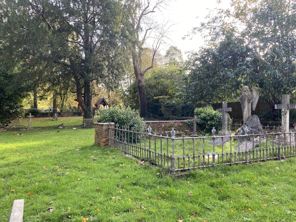
The church is now demolished, the grave is in a family plot enclosed by railings.
Visiting information
Access is permitted via a private garden. The landowner through whose property a car/pedestrian must pass has provided at his discretion a small car park area which has a compacted gravel surface (wheelchair friendly). The entrance to the churchyard is through a lych gate which is wide enough for a wheelchair. Thereafter it is the usual grassy surface with no paths.