Haldensleben Hospital Cemetery
- Country Germany
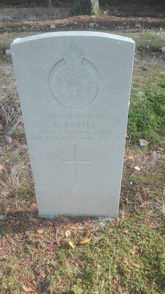
- Total identified casualties 1 Find these casualties
- Region Sachsen-Anhalt
- Identified casualties from Second World War
- GPS Coordinates Latitude: 52.28002, Longitude: 11.37223

Location information
Haldensleben is a town in east Germany approx 32 km north west of Magdeburg. From the A2 Hannover to Berlin motorway take exit 68 (Ausfahrt 68) DRESDEN / HALLE / SALZWEDEL / HALDENSLEBEN and follow A14 direction HALDENSLEBEN. Continue for approx 16.5 kms (road changes name to B71) and turn left onto B245 GERIKERSTRAßE, continue for approx 2.2 kms and turn left onto B245 HAGENSTRAßE continue for approx 300 m and turn right onto SÜPLINGER STRAßE, continue for approx 2.2 kms (road changes name to AM KÜNNECKENBERG and then KIEFHOLZSTRAßE) and turn left onto LÜNEBERGER HEERSTRAßE (signposted WALDSTADION) continue for approx 500m and turn right. The main entrance to the cemetery can be found after approx 200m on the left. The single CWGC grave is located to the left of the entrance and is easily visible from the road. The cemetery address is: Lüneburger Heerstraße 39340 Haldensleben Germany GPS Co-ordinates: N 52 16 48, E 11 22 25
History information
This hospital cemetery contains the grave of one Commonwealth servicemen of the Second World War, whose grave was rediscovered following the unification of Germany.