Liedekerke Communal Cemetery
- Country Belgium
- Total identified casualties 1 Find these casualties
- Region Vlaams-Brabant
- Identified casualties from Second World War
- GPS Coordinates Latitude: 50.87204, Longitude: 4.0874
Location information
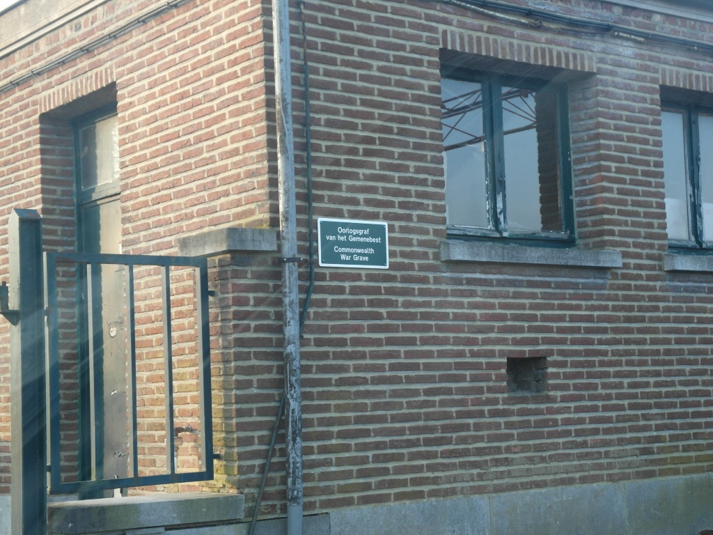
Liedekerke is a village 29 kilometres west of Brussels and south east of Aalst. The village is located approximately 2 kilometers south of the Brussel – Gent (A10 E40) motorway and 2 kilometres east of the Ninove-Aalst road. Brussels is the most convenient centre. From Brussel follow the E40 towards Gent then exit at junction 19a. Turn left towards Denderleeuw on Stationsstraat. After crossing the railway line continue to the round about and turn left into Affligemsestraat towards Liedekerke. After crossing the railway again take the fifth turning right into Papenbergstraat then take the first left into Molenstraat and the cemetery is located on the left approximately 500 meters from the junction. The Commonwealth burial is in a family vault and is the first grave on the right hand side of the main path after entering the cemetery.
History information
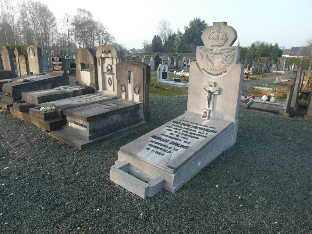
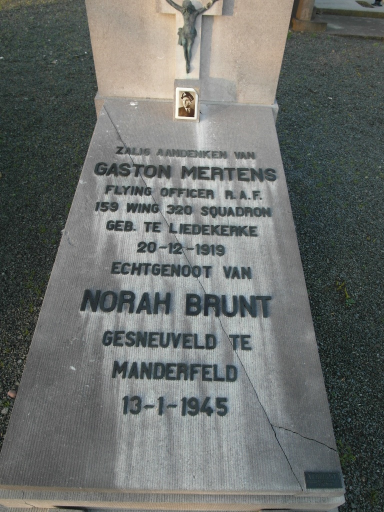
The British Expeditionary Force was involved in the later stages of the defence of Belgium following the German invasion in May 1940, and suffered many casualties in covering the withdrawal to Dunkirk. Commonwealth forces did not return until September 1944, but in the intervening years, many airmen were shot down or crashed in raids on strategic objectives in Belgium, or while returning from missions over Germany. Liedekerke Communal Cemetery contains one Commonwealth burial of the Second World War, that of a Belgian airman who served with the Royal Air Force.