Bosc-Le-Hard Communal Cemetery
- Country France
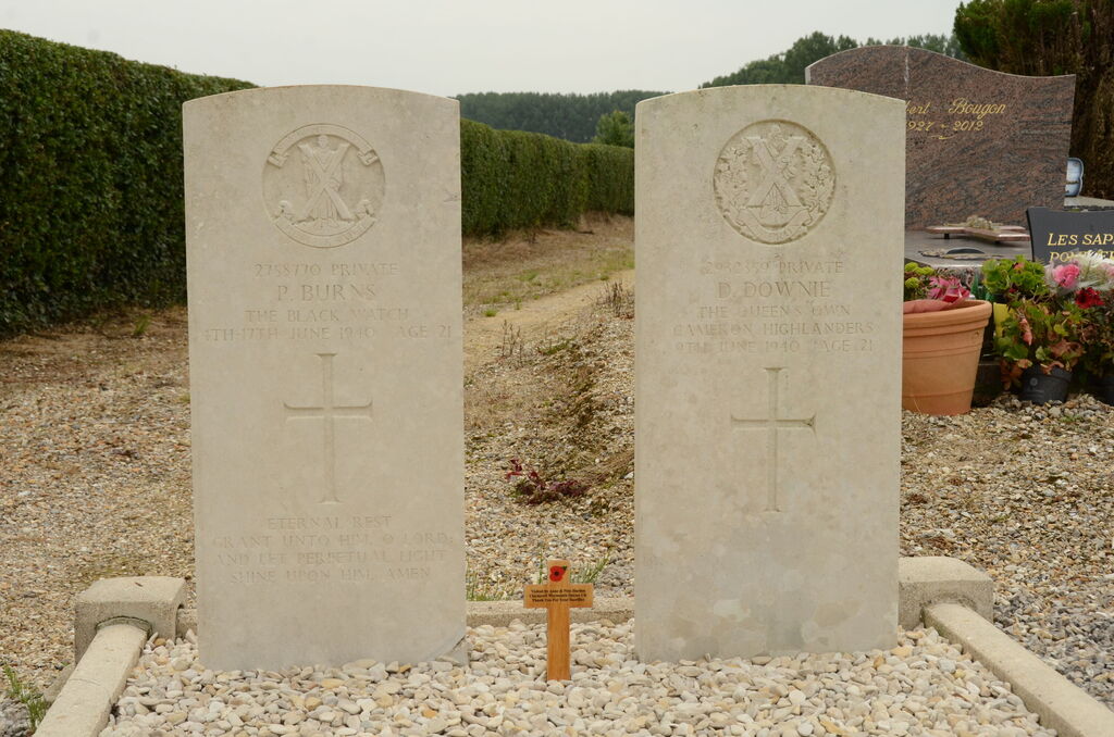
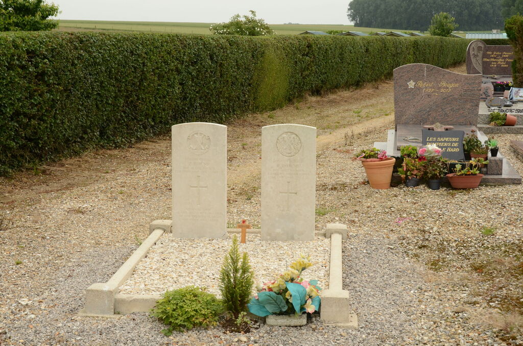
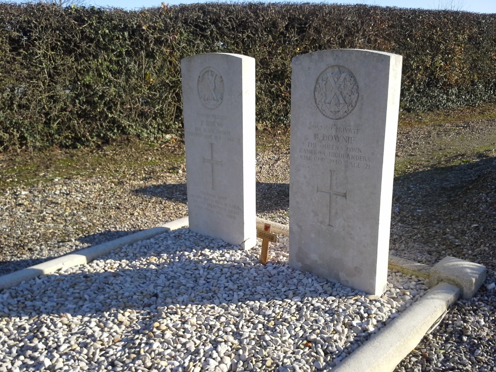
- Total identified casualties 2 Find these casualties
- Region Seine-Maritime
- Identified casualties from Second World War
- GPS Coordinates Latitude: 49.62729, Longitude: 1.18159
Location information
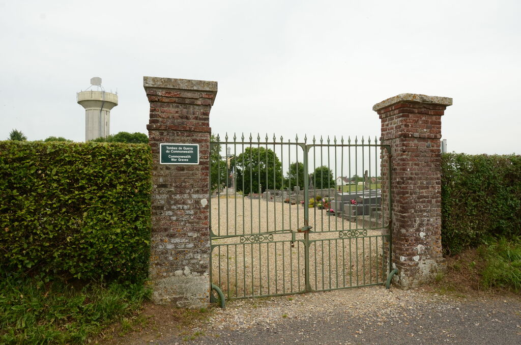
Bosc-le-Hard is a village and commune 15 miles north-north-east of Rouen. It is on the D.151 road from Igneauville, which is 5 miles (8 kilometres) from Rouen on the N.28 road from Rouen to Bellencombre and Abbeville. There is a railway station (Amiens-Serqueux-Le Havre line) and buses from Rouen to Bellencombre pass through the village of Bosc-le-Hard. The communal cemetery is on the south-east side of the village, some 400 yards from the church. The British graves are near the northern boundary of the cemetery and some 20 yards north-east of the 1870 war monument.