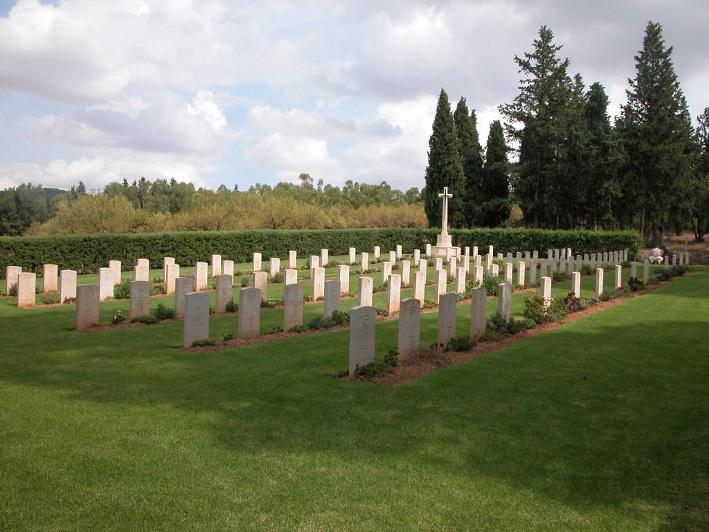
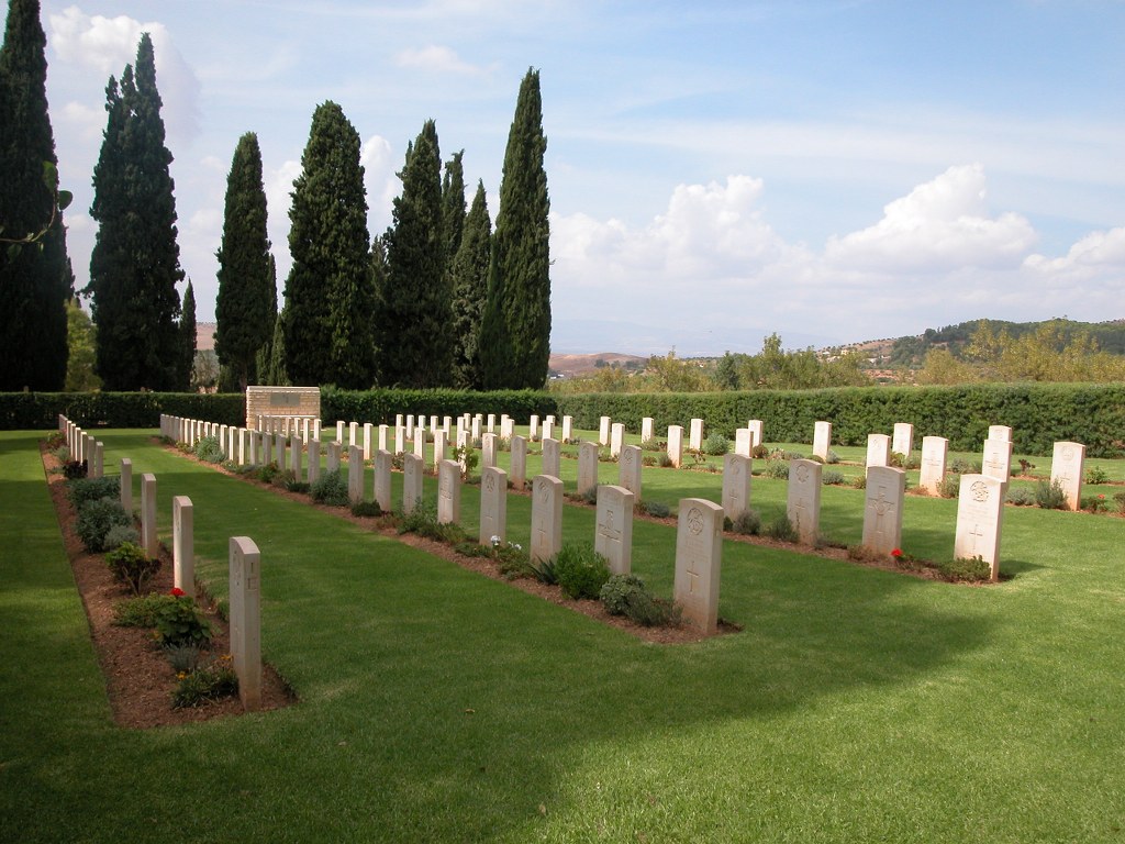
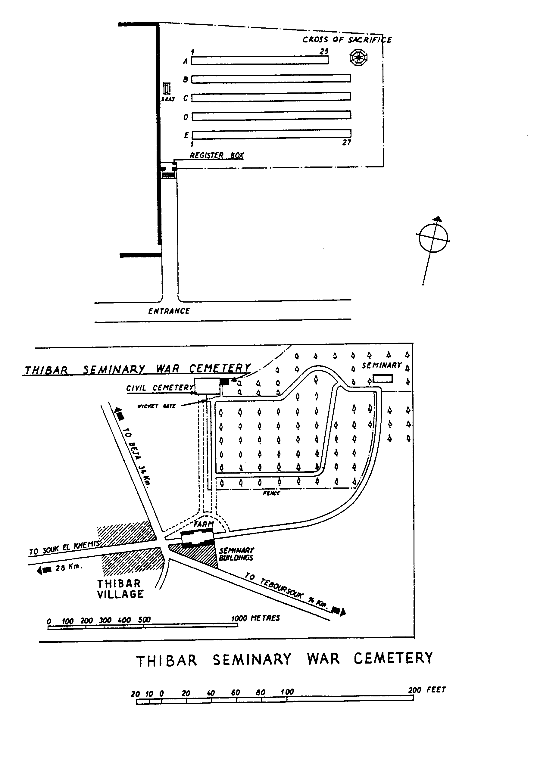
Thibar Seminary War Cemetery
- Country Tunisia
- Total identified casualties 99 Find these casualties
- Identified casualties from Second World War
- GPS Coordinates Latitude: 36.52748, Longitude: 9.10518
Location information
The Cemetery is approximately 800 metres north of the village of Thibar, which is some 30 kilometres south west of Beja on the road to Teboursouk. The cemetery adjoins the grounds of the Agricultural College. GPS Co-ordinates: Latitude: 36.527772, Longitude: 9.104833
Visiting information
The cemetery gates are not locked, so it is possible to visit the cemetery at all times, including Saturdays and Sundays. However, the register and visitors' book will not be available outside working hours, as they are kept locked in the gardeners tool shed. The gardeners hours of work are:
(Summer Hours)
July and August
Monday - Thursday 06:30 - 14:30
Friday 06:30 - 13:30
(Winter Hours)
September - June:
Monday - Thursday 07:00 - 12:00 and 13:00 - 17:00
Friday 07:00 - 12:00 and 13:00 - 16:00
Month of Ramadan:
Monday - Friday 07:00 - 14:00
For further information and enquiries please contact enquiries@cwgc.org
History information
In May 1943, the war in North Africa came to an end in Tunisia with the defeat of the Axis powers by a combined Allied force. On 8 November 1942, Commonwealth and American troops made a series of landings in Algeria and Morocco. The Germans responded immediately by sending a force from Sicily to northern Tunisia, which checked the Allied advance east in early December. Thibar was just behind the limit of the advance that winter. Thibar Seminary War Cemetery contains 99 Commonwealth burials of the Second World War.