Sorvik Churchyard
- Country Norway
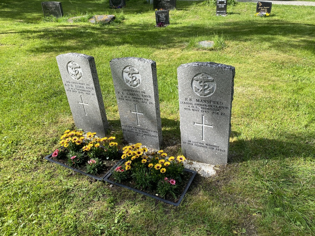
- Total identified casualties 3 Find these casualties
- Identified casualties from Second World War
- GPS Coordinates Latitude: 68.68372, Longitude: 16.5314
Location information
Sorvik is on the island of Hinnoy off the north west coast of Norway, 50 kilometres west of Narvik. Having crossed the bridge to the island on the E10, branch off on route 83 signposted to Sorvik and Harstad. On approaching the village from the south, the red wooden church can be seen off to the left. Turn left at the junction signposted for Straumen and Santorg church and the churchyard is found 200 metres along on the left side. Follow the path to the rear of the church. 50 metres beyond the church the three granite Commission headstones can be seen on the left side 20 metres from the path.
History information
During the Second World War, Norway was of strategic importance to the Germans. Their invasion on 9 April 1940 was sudden and widespread and despite Allied intervention, the entire country was under German occupation by early June. Thereafter, Allied activity in Norway was confined to raids and special operations, with the Commonwealth air forces providing support to Norwegian resistance groups until the German capitulation in May 1945. There are no Commonwealth war cemeteries in Norway, those who died there being buried in civil cemeteries and churchyards. Sorvik Churchyard contains the graves of three men of the Fleet Air Arm.